Is Dripping Springs in a Flood Zone? A Clear, Local Answer
Last updated: January 27, 2026
Dripping Springs is not entirely in a flood zone, but some specific areas and properties are. Most homes in Dripping Springs are outside FEMA’s high-risk flood zones, yet flood risk depends on the exact location, elevation, and proximity to creeks or drainage corridors.
Dripping Springs as a city is largely outside FEMA-designated high-risk flood zones, but flood zones exist in certain low-lying areas and along creeks. Flood risk is determined parcel by parcel, not by city name. You must check the exact address to know whether a property is in a mapped flood zone.
Flood zone status is based on FEMA Flood Insurance Rate Maps, which classify land by statistical flood risk. Properties near waterways, floodplains, or drainage channels are more likely to fall within regulated zones. Elevation, watershed size, and recent map updates also affect whether a property is classified as high risk or low risk.
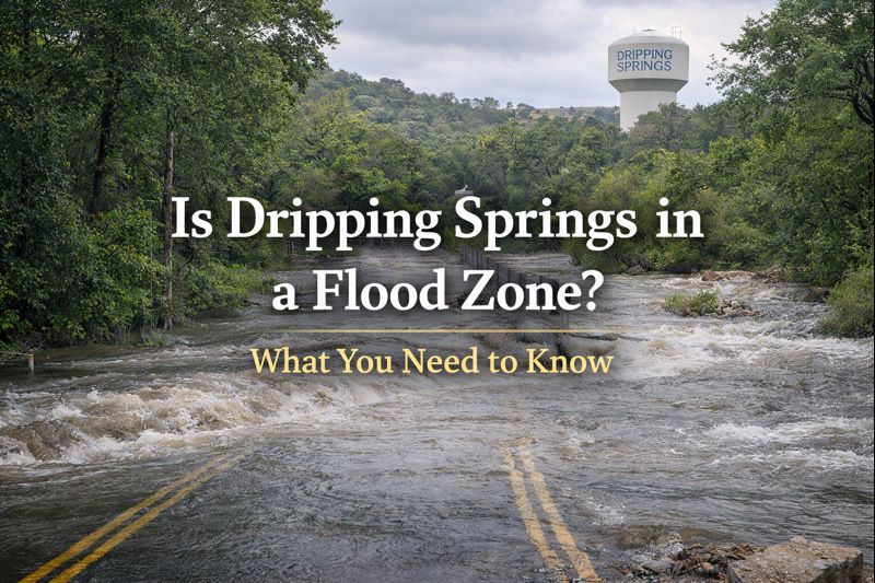
Many buyers assume that because Dripping Springs is in the Hill Country, flooding is not a concern. In reality, Hill Country terrain can produce flash flooding even outside mapped flood zones. Another common mistake is relying on county-wide or city-wide statements instead of checking the specific parcel on official maps.
In Dripping Springs and western Hays County, flood zones typically follow creeks, seasonal waterways, and low crossings rather than broad neighborhoods. A property can sit outside the FEMA 100-year floodplain but still experience water flow during extreme rain events. New construction on larger tracts may also involve unmapped drainage features that do not appear on older flood maps.
If a property is in a FEMA-designated high-risk zone, lenders usually require flood insurance. Even if flood insurance is not required, some buyers choose to carry it due to Hill Country rainfall patterns. Land buyers should be especially cautious, since raw land can include floodways or drainage easements that affect buildability and long-term use.
The only reliable way to confirm flood zone status is to check the exact address or parcel on official flood maps. FEMA Flood Maps are the primary source used by lenders and insurers. Hays County floodplain records and the City of Dripping Springs planning department can confirm local floodplain regulations. Surveyors and engineers can provide elevation certificates if clarification is needed.
Dripping Springs is not broadly located in a flood zone, but flood risk is highly location-specific. Some properties are affected, many are not, and assumptions based on the city name alone are unreliable. Always verify flood status at the parcel level before making a purchase decision.
If you want a risk-first read on a property or piece of land before you commit, reach out and we’ll map the red flags early. You can find more resources at https://chrispesek.com, email chris@drippingspringshometeam.com, or call 512-736-1703. Chris Pesek is a Texas Hill Country Realtor specializing in land, acreage, and custom homes. 383+ sales. Top 2 Percent Producer. 63 five-star reviews.